Going BEYOND Accuracy: The Hidden Costs of Inaccurate Surveys and How to Avoid Them
- Clinton Bravo
- Oct 16, 2025
- 8 min read

In Philippine construction and development, every project starts with one essential step: the survey. It’s the real-world map that guides multi-million-peso decisions. Choosing a “good enough” ("pwede na yan") survey to save time or money sounds practical, but it often becomes a very costly mistake. The hidden costs show up later wrong lot lines that trigger right-of-way issues, slabs that need to be rebuilt because control points were off, drainage that floods because ground levels were wrong, and delays when buried utilities aren’t where plans say they are. In a country with steep terrain, soft soils, and strong typhoons, guessing is not an option.
With an accuracy of approximately 98% (ranging from 5 cm to 10 cm), this survey is not just a “pwede na yan” type of survey. This level of precision should be the standard. If we were to enumerate the failed surveys of projects in the Philippines solely because companies nowadays prefer cheap or good enough surveyors, this enumeration would never end. Instead, we will look into the reasons why “good enough” surveys can cost you millions in the long run, resulting in unusable data.
What pays is certainty. Projects that start with a high-quality, LiDAR-based survey solid control points, dense topographic coverage, reliable elevations, and clear context move faster with fewer design changes and fewer site surprises. Accurate grades keep water flowing to the outfall, not into the lobby. True ground and tree-canopy models prevent undersized culverts and avoid extra earthworks. Corridor-wide mapping finds issues early so permits and mobilization don’t stall. Money saved at the start by cutting corners usually gets spent many times over later. In the Philippines, where every rainy week can slow a job, the smartest savings happen before the first excavation.
The Domino Effect of Inaccurate Data
An inaccurate survey is not a static error; it's the first domino to fall in a long line of costly problems. The consequences ripple through every phase of a project, creating hidden costs that dwarf any initial savings.
1. Financial Bleeding and Project Delays: When survey data is flawed, the design is flawed. This leads to what the industry calls "rework," which can add a staggering 5% to 20% to total construction costs. In the Philippines, studies have shown that factors like "inappropriate planning," "design errors," and "unforeseen site conditions" are primary drivers of budget overruns. An inaccurate survey is the direct cause of all three. A foundation designed for flat ground suddenly needs to be re-engineered for an unexpected slope, or a drainage plan is rendered useless by terrain data that was just slightly off. These "surprises" lead to work stoppages, frantic redesigns, and blown timelines.
2. Failed Projects and Wasted Funds: In the most extreme cases, the cost of bad data is total project failure. A chilling analysis of flood control projects in Bulacan by the NGO Pro-People Engineers and Leaders (Propel) revealed a shocking misalignment. Using the high-precision hazard maps from Project NOAH (Nationwide Operational Assessment of Hazards), they found that an incredible 411 out of 668 flood control projects were not located in any of the identified flood hazard areas.
Think about that: billions of pesos spent on infrastructure to protect communities, built in the wrong places. This is the direct result of projects proceeding without accurate, scientific data. It's not just a waste of money; it's a betrayal of public trust, leaving vulnerable communities exposed while "ghost" projects and poorly engineered structures offer a false sense of security.
When Cheaper Becomes Costlier
For many, drone photogrammetry or drone surveys seems like a modern, cost-effective solution. By stitching together high-resolution photos, it can create detailed 3D models. It has its place for smaller, simpler projects in ideal conditions. However, in the complex Philippine landscape, its limitations can lead to disastrous inaccuracies.
Consider these all-too-common scenarios where choosing photogrammetry or drone survey over LiDAR proves to be a critical failure:

Scenario 1: A high-rise developer flies a photogrammetry mission in a dense central business development city. These tall buildings create deep shadows and strong occlusions; narrow streets limit flight geometry. The resulting 3D model has gaps and local distortions, and when contractors set out utilities and foundations, clashes and redesigns follow. This is also a known limitation: image-based reconstruction in urban “canyons” is sensitive to occlusions, shadows, weak texture and constrained camera geometry, all of which degrade dense matching and propagate into DEM errors. Peer-reviewed studies on UAV pipelines show that shadowing and poor viewing angles in built-up areas reduce tie-point robustness and increase reconstruction noise problems that are much less pronounced with mobile/terrestrial or aerial LiDAR, which directly measures range and is not dependent on ambient light or textured surfaces.
Read full article study: https://pdfs.semanticscholar.org/7dce/9ed9fd2c84e2fb0eb6fc3a56db11fcfaa370.pdf

Scenario 2: A solar developer asked ABSD to step in after a previous provider’s drone survey produced maps they couldn’t use. Elevations didn’t line up from one flight path to the next, and the data wasn’t consistent across the site—making it risky to design grading, drainage, and foundations. We rebuilt the survey from the ground up: used survey-grade LiDAR equipment, added more well-placed ground checks, flew a tighter plan, and ran stricter quality checks on every pass. We finished the project within two weeks and the developer was satisfied and learned their lesson that redoing the whole thing is not cost efficient and that they should not settled with "pwede na" type of surveying from the start.

Scenario 3: A drone mapping project was undertaken to survey a large construction site with high accuracy demands (±5 cm). The team flew a DJI prosumer drone (without RTK) to collect aerial photographs for photogrammetry. The goal was to produce a site map and volume calculations for earthworks. Ground control was sparse – only a few ground control points (GCPs) were used due to time constraints. The consequences were immediate: when engineers cross-checked a few known points on site, the drone map did not line up, invalidating all the measurements. Volumetric estimates of earth moved were also unreliable, since a vertical offset of even 0.5 m can drastically change cut-and-fill calculations. The project’s deliverables were rejected due to not meeting the required accuracy standard. To recover, the team had to repeat the survey.
Read full article study:
The three case studies illustrate distinct failure modes of drone-based surveying technologies and underscore why traditional survey-grade instruments remain crucial in certain scenarios. First, drone photogrammetry can fail dramatically in environments with heavy vegetation or poor texture, as it simply cannot capture the ground through foliage, leading to incomplete or inaccurate maps. Second, achieving high absolute accuracy with drones requires proper geo-referencing (RTK/PPK or well-distributed GCPs); if these are neglected, the resulting models may have errors on the order of meters, failing to meet project requirements. Third, drone LiDAR while overcoming some limitations of photogrammetry is not immune to problems: calibration errors, multi-flight misalignments, or adverse conditions (like rain or IMU drift) can compromise the data’s integrity and accuracy. Each case showed consequences such as rework, project delays, or unusable data when the technology’s limits were exceeded.
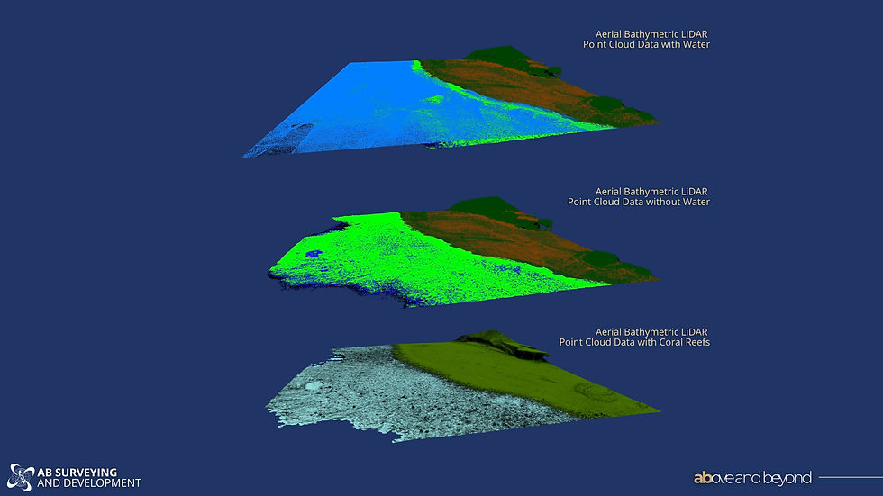
The LiDAR Revolution: Where Precision Pays Off
For the last decade, LiDAR has become the gold standard for surveying in the Philippines, precisely because it solves the problems that plague other methods. By firing millions of laser pulses and measuring their return, LiDAR actively maps the terrain with centimeter-level accuracy. Crucially, its laser pulses can penetrate vegetation to capture the "bare earth" and it can operate day or night, in various conditions.
The adoption of LiDAR in the Philippines, particularly in the last five years, has been transformative across multiple sectors: (Here are some of the different sectors ABSD works in, along with a few of its actual projects)
Disaster Risk Reduction: This is where LiDAR has had its most profound impact. National initiatives like the DREAM Program and its successor, Phil-LiDAR 1 and 2, systematically mapped the country's most critical river basins. These hyper-accurate 3D maps are the foundation of the country's modern flood and landslide preparedness, used by LGUs from Metro Manila to Mindanao to develop effective mitigation strategies.

Urban Planning and Infrastructure: As cities like Manila, Baguio and Cebu expand vertically and horizontally, LiDAR provides the detailed data needed for complex infrastructure project. It's used to design better drainage systems, plan road alignments, and ensure new developments are resilient to climate risks.

Mining and Agriculture: In the mining sector, LiDAR is essential for creating detailed 3D models of terrains and stockpiles to precisely calculate volumes, enhancing resource management and safety. The Phil-LiDAR 2 program specifically focused on creating a national inventory of agricultural resources, using the data to assess land for high-value crops and plan irrigation systems.


Comments