
LiDAR in Surveying — What It Is, How It Works, and Why It Matters
LiDAR has fundamentally changed what is possible in surveying — enabling teams to capture centimeter-accurate spatial data across vast, complex, and inaccessible areas faster and more completely than any conventional survey method. Whether you are encountering LiDAR for the first time or looking to understand it more deeply, this page explains the technology, how it is applied in surveying, and why it has become the tool of choice for the world's most demanding geospatial projects.
HOW IT WORKS
WHAT IS LIDAR?
LiDAR stands for Light Detection and Ranging. At its core, it is a remote sensing technology that measures distance using laser light,the same fundamental principle as radar, but using light pulses instead of radio waves.
A LiDAR sensor fires millions of laser pulses per second at the surface below or in front of it. Each pulse travels to the surface, reflects back to the sensor, and is recorded. By measuring the time it takes for each pulse to return, and knowing the speed of light, the sensor calculates the precise distance to every point it hits.
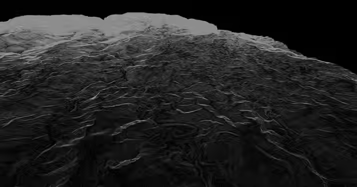
The result is a point cloud — a dense, three-dimensional collection of millions of georeferenced points that together form an extraordinarily detailed spatial picture of the surveyed area. Think of it as a 3D photograph of the landscape, accurate to the centimeter, covering areas that would take conventional survey teams weeks or months to measure on foot.
Combined with GPS positioning and inertial measurement systems that track the sensor's exact location and orientation at every moment, LiDAR produces spatial data that is both precise and geographically referenced, ready to be transformed into the terrain models, maps, and engineering datasets that projects depend on.
HOW LIDAR WORKS
01
A LiDAR sensor mounted on an aircraft, drone, vehicle, or tripod emits thousands to millions of laser pulses per second toward the ground and surrounding features.
02
The sensor measures the time it takes for each laser pulse to return, allowing the system to calculate precise distances and elevations using the speed of light, supported by GPS and an Inertial Measurement Unit (IMU) for accurate positioning.
03
Each pulse reflects back to the sensor, and the system measures the time it takes for the light to return.
04
These measurements form a dense LiDAR point cloud, which is processed to identify terrain, vegetation, buildings, and infrastructure.
05
The data is then used to produce accurate LiDAR mapping products such as Digital Terrain Models (DTM), Digital Surface Models (DSM), contours, orthophotos, and 3D maps.
Why LIDAR?
LiDAR vs Conventional Surveying Methods
For generations, land surveying relied on total stations, levels, and GPS receivers — instruments that measure one point at a time, requiring a surveyor to physically visit every location to be measured. These methods remain valuable for precise boundary and control surveys, but they have fundamental limitations when projects require comprehensive spatial data across large or complex areas.
LiDAR Surveying
The fastest available commercial surveying method, LiDAR technology, shortens fieldworks by as much as 95%.
Human error is minimized, ensuring constant accuracy for all equipment used at 15mm (recommended for highly vegetated areas)
All structural and natural features are included in final outputs
Entails virtually zero risk and requires only a few permits.
As the scope or area increases, the costs are relatively lowered and are less compared to traditional surveying methods.
Conventional
Tedious fieldwork, which may take months or years to complete, is often prone to delays.
Possibility of resurvey due to human error
No details of structures and features are included in final outputs
Need to set-up within high risk areas (i.e. illegal settlements) and access permits are required and often difficult to obtain
Surveying large areas require more manpower, equipment, and other resources
(Schedule)
Timeframe
Accuracy
Details of Structures and Features
Accessibility
Cost
Kinds of LiDAR Surveying Applications
LiDAR is not a single tool — it is a family of technologies, each configured for a specific surveying environment and application. Understanding the differences between them helps clarify which approach is right for a given project.
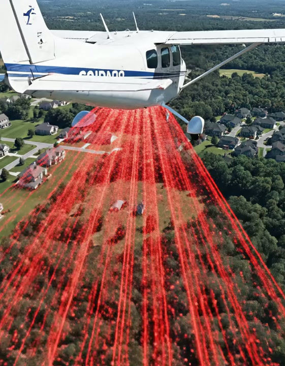
Aerial LiDAR Surveying (Topographic Surveying)
Aerial LiDAR mounts the sensor on a manned aircraft or unmanned aerial vehicle (UAV) and surveys the terrain from above. As the aircraft flies over the project area, the LiDAR sensor sweeps the ground below — capturing millions of laser returns per second across a swath of terrain. Aerial LiDAR is the most powerful tool available for large-scale topographic survey. It covers hundreds of hectares per flight day, penetrates vegetation canopy to reveal the bare-earth surface beneath, and produces sub-meter Digital Terrain Models (DTMs) across areas that would be impractical to survey any other way. It is the survey method of choice for wind farm site assessment, solar farm feasibility, transmission line corridor surveys, flood mapping, watershed modeling, and any project where large-scale terrain data is required quickly and accurately.
Mobile LiDAR Surveying
Mobile LiDAR mounts the sensor on a moving vehicle — a car, truck, or rail platform — and captures the surrounding environment continuously as the vehicle travels. GPS, inertial measurement, and distance measurement systems combine to georeference every point captured during the drive. Mobile LiDAR is the most efficient method for surveying linear infrastructure at scale — road corridors, railway lines, utility networks, and urban streetscapes. A mobile LiDAR system can capture a complete road corridor — geometry, pavement, drainage structures, signage, and roadside assets — at driving speed, without lane closures or traffic disruption.
Terrestrial LiDAR Surveying
Terrestrial LiDAR positions the scanner on the ground — on a tripod or fixed mounting — and captures the surrounding environment from one or more scan positions. Each scan position produces a dense, millimeter-accurate 3D point cloud of everything visible from that location. Multiple scan positions are registered together to produce a complete model of the structure or environment. Terrestrial LiDAR excels where detail and accuracy at close range are paramount — as-built documentation of buildings and infrastructure, heritage recording of historic structures and monuments, structural deformation monitoring, and confined-space surveys where aerial methods cannot operate. Unlike aerial LiDAR which looks down, terrestrial LiDAR looks outward — capturing vertical surfaces, architectural detail, and structural geometry with a level of precision and completeness that no other survey method can match.
Aerial Bathymetric (Hydrographic) LiDAR Surveying
Bathymetric LiDAR uses a specialized green-wavelength laser that penetrates the water surface and reflects from the seabed or riverbed below — unlike conventional LiDAR lasers which reflect from the water surface. This allows Aerial Bathymetric LiDAR to survey shallow to moderate-depth water environments from an aircraft in the same way that aerial topographic LiDAR surveys the land. The result is a seamless, integrated survey of the land surface and the underwater terrain in a single pass — a capability that is uniquely valuable for coastal zone management, offshore wind farm assessment, hydrological modeling, and nearshore infrastructure projects where the land-water boundary is critical. For deeper water or areas requiring higher underwater resolution, Multibeam Echosounder (MBES) hydrographic survey provides complementary capability — using acoustic rather than light-based measurement to map the seabed in detail.
Why Industry Players choose AB LIDAR.
Other Providers
Uses UAV with up to 122m altitude
Manual Processing
Up to 5-7 discreet returns
Susceptible to small tilts, rotations, or vibrations
Effective for small areas, but requiring multiple flights and data stitching
AB LIDAR Surveying
Uses manned aircraft up to 2,500m altitude
AI- Assisted Processing
Up to 15 discreet returns (for vegetated areas)
High-precision IMU for large areas
One flight covers vast areas, minimizing data fragmentation and ensuring higher accuracy.
It's time to switch to LIDAR.
Consult with one of The LIDAR Guys
Our Services
AB Surveying and Development operates a full suite of LiDAR and geospatial survey capabilities — aerial topographic LiDAR, aerial bathymetric LiDAR, mobile LiDAR, terrestrial LiDAR, and multibeam echosounder hydrographic survey — supported by survey-grade equipment from leading manufacturers including RIEGL and FARO.
Our team has delivered LiDAR surveys across a wide range of industries and environments — from the Philippines' largest solar farm development and transmission line corridors to heritage monument documentation, railway route alignment surveys, and mining tenement mapping.
Every project is delivered with full accuracy documentation, georeferenced to international datum standards, and formatted for the engineering, GIS, and regulatory platforms our clients use — whether that is AutoCAD Civil 3D, ArcGIS, Surpac, or a DENR ECC submission package.
.jpg)


_edited.jpg)


We were amazed at how fast AB Surveying and Development's LiDAR mapping was as compared to conventional surveying methods.
With approximately 1,000 hectares of land area, the Kiangan, Ifugao project site was accurately generated as a topographic map and was very useful for the planning and design of the proposed Hucab Mini Hydro Electric Plant. The team was very accommodating and helpful in every step of the way, and they almost eliminated the need for physical site inspection because of their attention to detail!
Highly recommended to all our industry peers!
Patrick Talibon, Business Line Manager, Pacific Tech Solutions, Inc.