
LiDAR Surveying for
Land Development
Every successful land development project — from a residential subdivision to a large-scale mixed-use estate — begins with accurate terrain data. AB Surveying and Development provides aerial, mobile, and terrestrial LiDAR surveying for land developers, project engineers, and property consultants across the Philippines — delivering the topographic surveys, grading data, drainage models, and tax mapping support that turn raw land into development-ready ground.
Challenges we solve
Common Challenges in Land Development and How LiDAR Addresses Them
Challenges
Inaccurate pre-development terrain data leads to costly grading design revisions
Drainage problems are discovered during or after construction — not during design
How LiDAR Helps
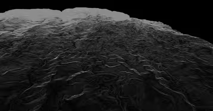
Land development grading designs built on coarse or outdated topographic data routinely encounter significant discrepancies between estimated and actual earthworks volumes, driving contract variations, budget overruns, and schedule delays that erode project returns. Micro-terrain features missed in conventional surveys — drainage swales, subtle ridgelines, and localized depressions — become expensive surprises during earthworks. Aerial LiDAR pre-development surveys capture the complete site topography at sub-meter resolution, giving grading designers, drainage engineers, and cost estimators a terrain model accurate enough to base final design decisions on reducing variation risk and improving earthworks cost certainty from the outset.
Flooding within completed subdivisions is a persistent problem in Philippine land development and it almost always traces back to drainage designs that didn't accurately account for site hydrology. Natural drainage paths blocked by subdivision roads, undersized culverts, and lots graded to drain toward neighbours rather than away are all symptoms of designing on imprecise terrain data. LiDAR-derived Digital Terrain Models support accurate hydrological analysis — delineating catchment areas, identifying flow accumulation paths, and revealing depression areas that would pond during rainfall events. This data allows drainage engineers to design systems that work with the site's natural hydrology rather than against it, reducing flooding risk and the costly remediation that follows.
Lot boundary verification and tax mapping are time-consuming and inconsistently done
As developments grow and lots are transferred, subdivided, and improved, keeping cadastral records aligned with physical ground conditions becomes increasingly difficult. Boundary disputes, unregistered improvements, and RPT assessment gaps are common consequences — creating legal exposure for developers and revenue leakage for LGU assessors. LiDAR orthophoto maps, overlaid with cadastral boundaries at high resolution, make discrepancies between official records and ground reality immediately visible — supporting boundary verification, encroachment identification, and RPTA compliance across the entire development in a single data product.
HLURB / DHSUD subdivision approval submissions require spatial data that conventional surveys can't efficiently produce
Subdivision development plan approvals from HLURB and DHSUD require accurate topographic maps, drainage studies, and environmental assessments that depend on reliable spatial data. Conventional survey methods are often too slow and too coarse to efficiently produce the data quality these submissions require — particularly for large development sites where rapid turnaround is critical to keeping project timelines on track. AB Surveying provides survey-grade LiDAR datasets with full accuracy documentation formatted for direct use in HLURB and DHSUD submission packages, reducing the time from land acquisition to regulatory approval.
Large development sites are difficult to survey quickly enough to keep pace with design and approvals timelines
Large-scale land development projects operate on tight timelines — land acquisition costs money every day the project isn't generating revenue, and regulatory approvals have their own schedules that don't wait for slow survey programmes. Conventional ground surveys of large development sites take weeks or months to complete, creating a survey bottleneck that delays design, approvals, and ultimately project launch. Aerial LiDAR surveys cover hundreds of hectares per flight day, delivering a complete topographic dataset of even the largest development sites within days of mobilization — keeping design and approvals timelines on track from the earliest project stage.
LiDAR Surveying Applications for Land Development
From initial site assessment through subdivision design, regulatory approval, and construction, LiDAR data supports every phase of the land development lifecycle in the Philippines.
Pre-Development Topographic Survey
Aerial LiDAR baseline survey of development sites — capturing terrain, vegetation, existing structures, and drainage features for subdivision design, grading engineering, and project feasibility assessment.
Drainage Design & Hydrological Modeling
LiDAR-derived catchment delineation, flow path mapping, and depression analysis — providing the hydrological basis for subdivision drainage system design and flood risk assessment.
Subdivision Road & Infrastructure Alignment
LiDAR terrain models for road alignment optimization, pavement design, and utility corridor planning within subdivision developments — minimizing earthworks cost and maximizing lot yield.
Large Site Rapid Topographic Coverage
Aerial LiDAR surveys of large development landbanks — delivering complete topographic data for hundreds of hectares within days, keeping design and approvals timelines on track.
Lot Grading & Earthworks Design
Sub-meter terrain models for precise grading plan development — supporting cut-and-fill optimization, earthworks volume estimation, and construction cost certainty before mobilization.
Tax Mapping & Cadastral Overlay
High-resolution orthophoto maps overlaid with cadastral boundaries — supporting lot boundary verification, encroachment identification, and RPT compliance for developers and LGU assessors.
HLURB / DHSUD Submission Data Support
Survey-grade topographic, drainage, and land cover datasets formatted for subdivision development plan submissions to Philippine housing and land use regulators.
Tax Mapping Support for LGU Assessors
Orthophoto and cadastral overlay products formatted for assessor's office use — enabling identification of unregistered improvements, verification of lot extents, and updating of the tax map .

What Our Clients Get:
3D Colorised Point Cloud Data
A point cloud data containing millions of precisely located points overlaid with orthophoto RGB creating a realistic 3D city model.


Our Services
.jpg)


_edited.jpg)

We were amazed at how fast AB Surveying and Development's LiDAR mapping was as compared to conventional surveying methods.
With approximately 1,000 hectares of land area, the Kiangan, Ifugao project site was accurately generated as a topographic map and was very useful for the planning and design of the proposed Hucab Mini Hydro Electric Plant. The team was very accommodating and helpful in every step of the way, and they almost eliminated the need for physical site inspection because of their attention to detail!
Highly recommended to all our industry peers!
Patrick Talibon, Business Line Manager, Pacific Tech Solutions, Inc.