
AB Terrestrial
LiDAR Surveying
For Architectural and As-Built Survey.
Terrestrial LiDAR Surveying is a ground-based laser scanning method used to capture highly accurate 3D measurements of buildings, landscapes, and other surface features. Unlike aerial LiDAR, terrestrial systems are mounted on tripods or vehicles and scan from the ground level—ideal for detailed and close-range mapping.
At AB Surveying & Development (ABSD), we use terrestrial LiDAR technology to deliver high-resolution 3D models that support structural monitoring, infrastructure planning, mining operations, and heritage conservation. This scanning method is perfect for areas that require precise detail—like tunnels, building interiors, industrial plants, or excavation sites.
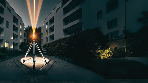
Aiming for the most precise architectural as-built survey, AB Surveying & Development is the among the first in the country to use the FARO Focus 3D X330 Scanner for commercial survey purposes. Capable of up to 976,000 meas/sec, the Focus 3D X330 captures every important architectural detail. ABSD's terrestrial LiDAR capabilities can produce reliable life-like visualization, even under extreme light conditions or enormous distances .
AB Surveying & Development uses FARO Focus 3D X330 Laser Scanner
What's making Terrestrial LiDAR Scanning Possible?

Click here for more information on the FARO Focus 3D X330 Laser Scanner.


