UP GE Club’s "Conquest" to Delve into the 3D Application of Terrestrial Laser Scanners
Will engineering and architecture students embrace the technology?
Oct. 28, 2018 | Quezon City, Philippines

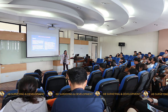
In Photo
Geodetic Engineer Lyka Magnayi discussing the principles of Terrestrial Laser Scanning
OCT 18 - In partnership with UP Geodetic Engineering Club, AB Surveying and Development (ABSD) was able to share its knowledge on Terrestrial Laser Scanners (TLS) to a group of enthusiastic engineers and architects, during Conquest, the Alternative Classroom Learning Experience (ACLE) Activity of UP GE Club, held at the GE Theater, College of Engineering, University of the Philippines Diliman, last October 18, 2018.
ACLE is purposely done every semester to give the opportunity for university students to learn outside the usual classroom setting. Through this avenue, Lyka Selene Magnayi, one of ABSD’s Geodetic Engineers, took the chance to contribute to the integrated learning of future engineers. She delivered a talk on TLS and how LiDAR makes these laser-equipped instruments work as today’s most advanced technology in mapping and surveying. Various applications of TLS were discussed such as, structural surveys, archaeology and cultural heritage documentation, forensics, construction and civil engineering, power line adjustment, railways track and pipeline inspection, to mention a few. The application of the modified TLS for mobile or moving surveys was also given focus during the discussion, revealing that it is the technology behind the newly introduced driverless cars.
To see an actual laser scanner do and showcase its capability was the special feature of this outside-the-classroom learning experience. Moving from the discussion at the GE Theater, students gathered at the Engineering Steps to watch the demonstration of ABSD’s TLS equipment, the FARO Focus 3D X 330. In their delight to have seen this, an exchange of questions and answers occurred while the equipment graze the surrounding with its laser.
Back at the GE Theater, a pre-processed data on the Engineering Steps, that was captured prior to the event, was shown to the group and each one was given the chance to explore the point cloud using AutoCAD RECAP. Another pre-processed point cloud data on the UP Oblation, was also shown to the students. Through this on-hands experience, they were able to appreciate the extent of data and information gathered by terrestrial laser scanners.
