top of page

AERIAL TOPOGRAHIC
LIDAR SURVEYING
Ideal for large-scale land, flood, and geohazard mapping where vegetation penetration is crucial.
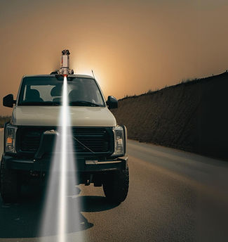
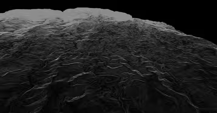
Aerial Topographic LiDAR Surveying is a smart and efficient way to scan land from above using lasers mounted on aircraft. As the aircraft flies, the LiDAR system sends out rapid laser pulses to the ground. These pulses bounce back and are used to create accurate 3D maps of the terrain—even through thick vegetation.
At AB Surveying & Development (ABSD), we use Aerial Topographic LiDAR to help clients get high-resolution data quickly and safely, without disrupting the environment. This method is perfect for large areas, hard-to-reach locations, and time-sensitive projects.
Whether it's for infrastructure planning, land development, flood modeling, or environmental monitoring, our LiDAR mapping services deliver reliable results with sub-meter precision.

Faster Fieldwork

Higher Accuracy

Richer Details

Smarter in Cost
OUR LIDAR SERVICES


WHAT'S MAKING AERIAL LIDAR POSSIBLE?

RIEGL VQ-580 II S LIDAR SCANNER

RIEGL VUX-240 LIDAR SCANNER

RIEGL VUX-1LR LIDAR SCANNER
AB Surveying and Development employs survey-grade LiDAR equipment optimized for large-area and corridor mapping. Our systems ensure fast, accurate, and reliable data acquisition, delivering high-quality outputs for a wide range of airborne LiDAR applications. From advanced equipment and efficient project scheduling to expert personnel and rapid data delivery, we go beyond traditional surveying to provide comprehensive, value-driven solutions.


OTHER SERVICES


bottom of page