top of page

AERIAL BATHYMETRIC
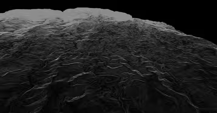
LIDAR SURVEYING
Ideal for shallow, clear waters, coral reef areas, coastal mapping, and port surveys.
At AB Surveying & Development (ABSD), we’re proud to be the first company in Southeast Asia to offer Aerial Bathymetric LiDAR. This innovation marks a major leap forward in sustainable surveying, especially for large-scale projects like offshore wind farms, coastal planning, and marine biodiversity protection.
Offers rapid data collection and highly detailed mapping of underwater terrain, achieving up to 200,000 measurements per second with an accuracy of about 2 centimeters.

Faster Fieldwork

Higher Accuracy

Richer Details

Smarter in Cost
OUR LIDAR SERVICES
.jpg)

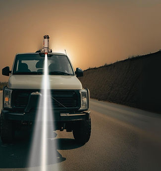

RIEGL 840-G LIDAR SCANNER
WHAT'S MAKING AERIAL BATHYMETRIC LIDAR POSSIBLE?
AB Surveying and Development uses the RIEGL VQ-840-G for aerial bathymetric LiDAR, capturing accurate depth and high-resolution topo-bathy data over coastal and shallow water areas. Our system delivers fast, precise, and reliable mapping for coastal engineering, flood modeling, and hydrographic applications.


OTHER SERVICES


bottom of page