A Decision-Ready Basemap for Santa Rosa: How LiDAR Strengthens Planning, DRRM, and Revenue Work
- Clinton Bravo
- Feb 12
- 4 min read


Most Local Government Units (LGUs) do not struggle because they lack plans. They struggle because plans move faster than the base map supporting them. When the baseline is incomplete, inconsistent, or outdated, implementation becomes reactive. Designs get revised, timelines slip, and decisions become harder to defend across offices.
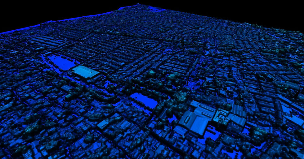
This is why the City Government of Santa Rosa invested in comprehensive LiDAR mapping as a foundation for city-wide plans and initiatives like drainage planning and related urban infrastructure activities. The goal was straightforward: generate high-resolution topographic data that can support their goals e.g. better drainage design and help mitigate flood risks, while also enabling broader planning and governance use cases.
A decision-ready basemap is not just something that looks accurate on a screen. It is a baseline that offices can actually use for day-to-day work, especially when decisions involve budgets, engineering designs, and risk reduction.
In Santa Rosa’s context, the deliverables were designed to be suitable for terrain modeling, urban analysis, and infrastructure planning. This directly supports planning workflows where elevation behavior, surface conditions, and the built environment must be interpreted consistently across teams.
Project scope and purpose
The Santa Rosa project involved comprehensive LiDAR mapping to support drainage planning and related infrastructure priorities. The primary objective was to produce high-resolution topographic data that the city can use to improve drainage systems and support flood-risk mitigation.
The deliverables included processed LiDAR data suitable for:
Terrain modeling
Urban analysis
Infrastructure planning

What made this project stand out was not only the completion of contractual requirements, but the voluntary initiatives AB Surveying and Development (ABSD) implemented to maximize value and usability for the city.
ABSD processed and compiled raw imagery into a fully geo-rectified orthophoto mosaic, even though this was not part of the original Terms of Reference (TOR). This strengthened the practical usability of the outputs, particularly for LGU teams that rely on clear visual basemaps to communicate site conditions and planning contexts.
To ensure the city could actively use the LiDAR outputs, ABSD also provided a dedicated laptop pre-installed with Global Mapper, along with hands-on orientation and basic training focused on LiDAR data handling and visualization. For LGUs, this kind of enablement matters because a high-quality dataset only becomes impactful when internal teams can open it, review it, and apply it in actual planning workflows.
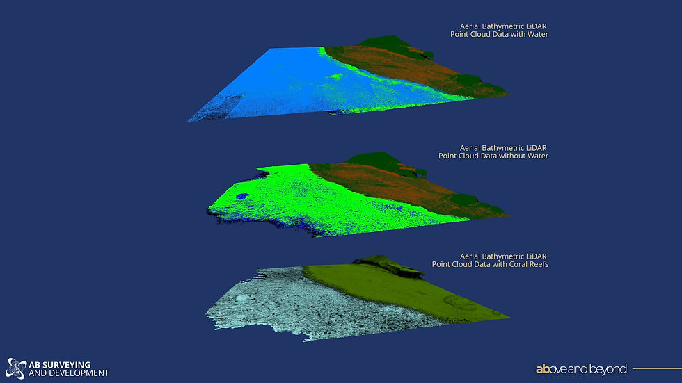
ABSD also conducted supplemental marine surveys using echosounders to map accessible sections of the main river system, even though hydrographic acquisition was not included in the scope. This added another layer of practical value, especially for LGU planning contexts where river systems are often central to drainage behavior and flood risk.
Challenges: a compressed timeline, weather risks, and urgency from Comprehensive Land Use Plan (CLUP) updates. Weather conditions were intermittent and unpredictable, which increased operational risks and posed potential acquisition delays. Despite an original timeline of 45 days, ABSD completed the project in 36 days. This required careful coordination, optimized flight planning, and rapid processing workflows, particularly because the city government was also updating its CLUP. That parallel activity raised the urgency for delivery because basemap availability affects the quality and defensibility of planning inputs.
Why the Santa Rosa context is uniquely demanding
Santa Rosa is a highly urbanized LGU with thousands of structures densely distributed across the city. That density raises the technical bar for both acquisition and processing, because fine-scale features must be captured accurately and consistently.
What made the project unique was the combination of:
dense urban complexity
high positional accuracy requirements
a compressed timeline
This kind of environment rewards disciplined execution because minor inconsistencies in baseline data can cascade into planning and design challenges later.
Impact
The outputs from this project are positioned as a foundational basemap for current and future initiatives within Santa Rosa.
Because the LiDAR dataset is high-accuracy, it supports applications including:
drainage design
flood simulation modeling
structural inventory
tax mapping

For LGUs, this is the practical value of a decision-ready baseline. The same dataset can support engineering and DRRM use cases while also strengthening revenue-related work streams that depend on a more reliable structural inventory.
By providing a comprehensive geospatial baseline, the project strengthens Santa Rosa’s capacity for data-driven urban planning, disaster resilience, and long-term infrastructure development.
A useful comparison: While Naga City uses LiDAR for flood and disaster planning, Santa Rosa’s work is about enabling citywide planning and governance using a reliable baseline. A similar logic shows up in ABSD’s work with Naga City, where LiDAR-based mapping supports disaster and flood planning by making it easier for LGUs to identify low-lying areas, understand drainage flow paths, and prioritize interventions using measurable conditions rather than outdated references.
The key connection between Naga City and Santa Rosa is not the exact deliverables. It is the governance principle behind them: flood readiness improves when the city can consistently “see” terrain behavior and drainage constraints through a survey-grade baseline map, instead of relying on incomplete layers that create uncertainty.
What LGUs can take from the Santa Rosa project
Santa Rosa’s case highlights three practical lessons for LGUs:
A high-quality basemap becomes more valuable when the project includes enablement, such as training and tools, so teams can actually use the outputs.
Time pressure does not automatically reduce quality, but it requires disciplined coordination, optimized acquisition planning, and fast processing workflows.
A single decision-ready baseline can support multiple offices at once, including planning, DRRM, and revenue-related work, because the dataset creates a shared reference for the city.


Comments