From Hesitation to Innovation Success Stories: Mapping the city of Baguio in 6 months
- Clinton Bravo
- Feb 25, 2025
- 2 min read

Singapore used LiDAR to make 3D maps for urban planning, disaster risk management, and environmental sustainability. In 2014, they started the program to improve planning for underground utilities and flood management. Since traditional surveying methods capture data points only a few meters apart, leaving significant gaps—particularly in flood-prone zones and vegetation modeling—these inaccuracies can undermine efforts to build a disaster-resilient community, LiDAR was chosen to complete the project. LiDAR is a game-changer. It uses laser pulses to make super-detailed terrain maps with incredible accuracy, down to the centimeter! This level of precision is necessary when modeling Singapore’s dense urban environment or monitoring climate-related changes.
Similarly, Baguio City’s steep terrain, dense forests, and tightly packed urban layout made traditional surveying nearly impossible, requiring years to navigate vegetation and secure homeowner permits for access.
AB Surveying and Development (ABSD) solved this with Aerial LiDAR Mapping, which rapidly captured high-precision data by flying over the city—bypassing physical obstacles, access restrictions, and delays. This groundbreaking approach made Baguio the first LGU in the Philippines to adopt LiDAR at scale, enabling faster, more accurate flood mapping, infrastructure upgrades, and disaster risk planning.


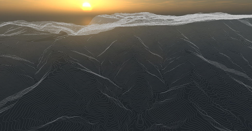
Despite the initial challenges in introducing LiDAR's capabilities during the beginning of aerial mapping of the entire city of Baguio, ABSD was fortunate enough to secure and complete the assignment. ABSD delivered survey-grade topographic maps, digital surface and terrain models (DSM-DTM), and as-built maps of all buildings and infrastructure.
Aerial LiDAR Mapping of Baguio City
✔Goal: Provide a detailed base map for flood mapping, tax mapping, road upgrades, and disaster risk mitigation
✔ Execution: ABSD surveyed 5,750 hectares—making Baguio the first LGU in the Philippines to use LiDAR at this scale
✔ Results: Delivered survey-grade maps, DSM-DTM models, and as-built maps of buildings and infrastructure
Why should LGUs Choose LiDAR?
📌 Faster, more accurate data collection – Reducing human intervention resulting in minimal human error, ensuring 95% accuracy.
📌 Enhanced accessibility, even in challenging terrains – LiDAR can penetrate dense vegetation and challenging terrain.
📌 Higher precision than conventional methods – ABSD uses survey-grade LiDAR technology, which is commonly used by European countries, to ensure precise measurements and outputs.
Want to see how LiDAR can help your city? Let's build a disaster-resilient future together!
Get a quick quotation today: https://www.absurveyingph.net/get-a-quick-quotation


Comments