![[ABSD] White Logo.png](https://static.wixstatic.com/media/c6ec9d_74fae8190bdc4b4bbae4d07cc36b8aff~mv2.png/v1/fill/w_193,h_48,al_c,q_85,usm_0.66_1.00_0.01,enc_avif,quality_auto/%5BABSD%5D%20White%20Logo.png)
Surveying for Renewable Energy Projects: From Site Selection to Transmission Line Development
Renewable energy projects are often defined by what will eventually be built: rows of solar panels, wind turbines, hydropower facilities, geothermal plants, or offshore infrastructure. But long before construction begins, developers need to answer a more fundamental question: How well do we actually understand the site we are planning to develop?
A renewable energy site may cover hundreds or thousands of hectares. It may extend across mountainous and heavily vegetated terrain, cross rivers and waterways, continue offshore, or require kilometers of new transmission infrastructure before the generated power can even reach the grid. What appears suitable on a satellite image may look very different once accurate elevations, slopes, drainage paths, existing structures, vegetation, property boundaries, underwater terrain, and other physical conditions are considered.
This is where surveying becomes an important part of renewable energy development. From Aerial LiDAR surveying to hydrographic and bathymetric surveys, different technologies can provide the geospatial information developers and engineers need throughout the project lifecycle.
The important question is not simply, “Do we need a survey?”
It is: “What do we need to understand about the site before making the next project decision?”
Surveying Starts Before Construction
Surveying is sometimes associated primarily with detailed engineering and construction. However, for renewable energy developments, its value can begin much earlier.
During site selection and feasibility, accurate terrain information can help developers better understand the physical characteristics and constraints of candidate sites. As the project moves into planning and detailed design, more detailed survey information may be required for roads, facilities, drainage, transmission corridors, waterways, and other project components. As the project progresses into planning, design, and construction, the type and level of survey information required may become increasingly detailed or localized.
In other words, a renewable energy project may require different types of surveys at different stages. The requirements can also change considerably depending on whether the project involves solar, onshore wind, offshore wind, hydropower, or geothermal energy.
Solar Energy/Solar Farms

A proposed solar farm may initially appear straightforward, particularly when the site looks relatively flat and open on satellite imagery. But a project covering hundreds of hectares can contain elevation differences, slopes, drainage paths, vegetation, existing roads, structures, and other features that are difficult to fully appreciate from imagery alone. These conditions can become increasingly important as engineers begin planning how the site will actually be developed.
A Topographic Survey provides accurate information about the existing physical characteristics of the site. For larger areas, Aerial Topographic LiDAR can be particularly valuable because it can collect dense elevation information across extensive project areas within a relatively short acquisition period.

From the LiDAR point cloud, surveyors can produce a Digital Terrain Model (DTM) representing the underlying ground, together with contours and other elevation products. These datasets can help project teams evaluate terrain, slopes, drainage patterns, existing site conditions, and other physical factors relevant to planning and engineering. If a camera is integrated with the LiDAR system, high-resolution aerial imagery and an orthophoto can also provide a current visual reference of the site.
The important point for developers is that a site should not be evaluated solely by how much land appears available. Understanding the physical characteristics of that land early can provide valuable information before the project progresses further into planning and design.
Onshore Wind Farm

Onshore wind developments present a very different surveying challenge. Potential wind farm sites may be located across mountain ridges, remote areas, or heavily vegetated terrain. These same conditions that may make a location attractive for wind development can make conventional field surveying more difficult and time-consuming.
Before engineers can properly evaluate turbine areas, access roads, transmission corridors, and supporting infrastructure, they need an accurate understanding of the terrain. Conventional topographic surveying requires survey crews to physically access locations throughout the project area, establish survey positions, and collect measurements from the ground. For a small, accessible site, this may be practical. For a large wind development extending across difficult terrain, the logistics can change considerably.
Aerial LiDAR allows large areas to be surveyed from an aircraft while collecting dense three-dimensional measurements across the project site. Importantly, LiDAR can also collect measurements through openings in vegetation. These ground returns can be classified during processing to develop a DTM representing the terrain beneath the vegetation.
This information can provide engineers and developers with a better understanding of terrain and elevation, slopes, potential access corridors, natural drainage paths, existing roads and infrastructure, proposed development areas, and transmission corridors.
However, not all LiDAR systems provide the same results. Point density, multiple-return capability, sensor performance, positioning and inertial measurement systems, acquisition methodology, and data processing can all influence the resulting terrain information. This becomes particularly important when surveying large, mountainous, and heavily vegetated project areas.
For wind developers, the value is in understanding these physical constraints earlier in the project, so they can be incorporated into feasibility, planning, and engineering decisions rather than discovered further into development.
Hydropower

Hydropower provides a clear example of why a single survey method may not provide all the information a project requires. A hydropower development may involve surrounding terrain, watersheds, access areas, rivers, reservoirs, and proposed infrastructure.
An Aerial Topographic LiDAR Survey can provide detailed information about the land surrounding the river or reservoir, including terrain, slopes, riverbanks, drainage paths, and potential infrastructure areas. But topographic LiDAR generally does not provide the same information about terrain beneath the water.
This is where hydrographic surveying may become necessary. Depending on the project and water conditions, a Single Beam Echo Sounder (SBES), Multibeam Echo Sounder (MBES), or Aerial Bathymetric LiDAR may be used to collect information about underwater terrain.
SBES collects depth measurements along survey lines and may be appropriate for certain rivers and reservoirs, while MBES collects dense measurements across a wider underwater swath where more detailed bathymetric coverage is required. For suitable clear and shallow waters, Aerial Bathymetric LiDAR may provide another method for mapping submerged terrain.
When topographic and bathymetric datasets are integrated, project teams can work with a more continuous representation of the environment extending from the surrounding land into the waterway. For a project involving a river or reservoir, this can help avoid an information gap precisely where the land and water environments meet.
Geothermal Energy
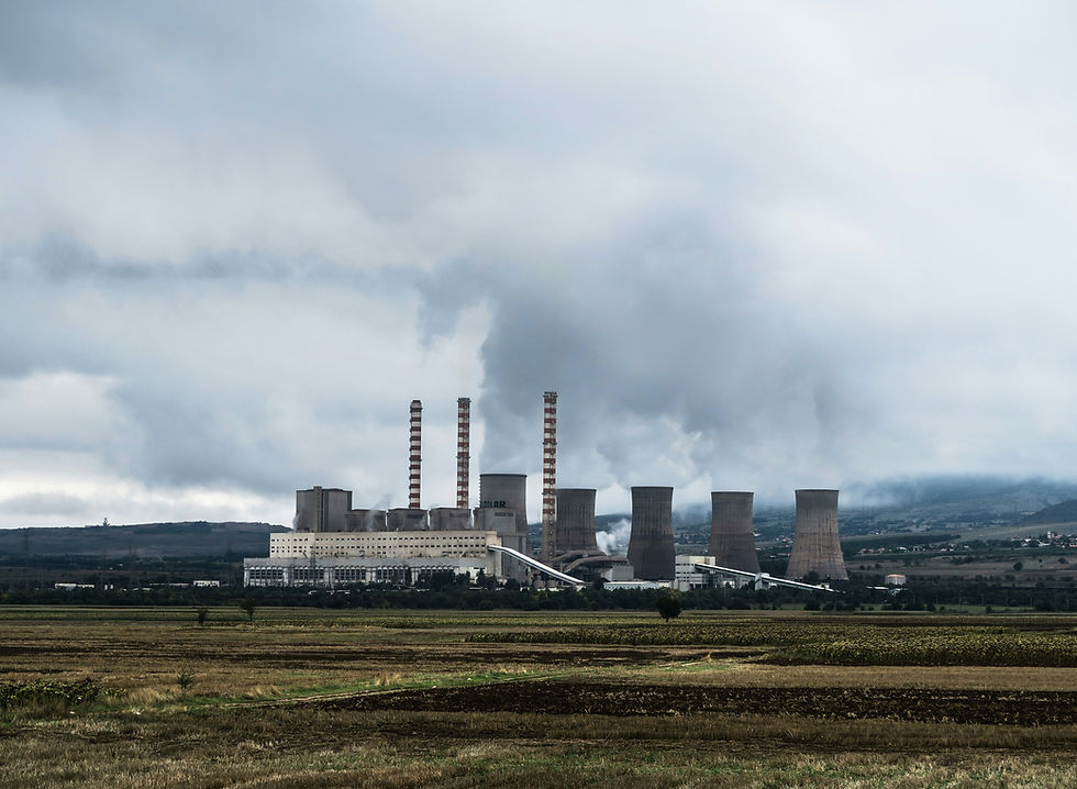
Geothermal developments can involve much more than the area where the geothermal resource is located. A project may include mountainous or heavily vegetated terrain, access roads, well pads, pipelines, power plant facilities, transmission infrastructure, and other supporting structures.
At the broader project level, Aerial Topographic LiDAR can provide detailed terrain and existing-condition information across large areas. The resulting DTM, contours, and point cloud can support planning activities involving access, facility locations, corridors, drainage, and other surface infrastructure.
As the project progresses into developed areas, however, the required level of detail can change.
Terrestrial LiDAR can be particularly useful within geothermal power plants and other facility areas because it captures highly detailed three-dimensional information about existing structures, equipment, piping, and the surrounding built environment. This can provide a measurable 3D representation of existing conditions that may support engineering activities involving existing facilities, modifications, expansions, and as-built documentation.

The important distinction is that LiDAR does not identify the geothermal resource itself. Instead, different LiDAR technologies can help developers understand the physical environment and existing infrastructure required to develop and operate the resource.
Offshore Wind: Understanding What Lies Above, On, and Beneath the Seabed

Offshore wind expands the surveying requirement even further. The project may extend from an onshore connection point, across the coastline and shallow water, through offshore cable corridors, and into turbine development areas farther from shore. This means developers may need information across several very different environments.
Aerial Topographic LiDAR can provide terrain information for landfall areas, proposed onshore facilities, access routes, and other land-based project components.
For clear and shallow coastal areas, Aerial Bathymetric LiDAR may be applicable for mapping underwater terrain where conditions are suitable.
Farther offshore, Multibeam Echo Sounder (MBES) surveying can provide detailed information about water depth and seabed topography. But knowing what the seabed looks like may still only answer part of the engineering question.
A Sub-bottom Profiler (SBP) can provide information about sediment layers and subsurface structures beneath the seabed, helping project teams better understand subsurface conditions along proposed development areas and cable corridors.
A Marine Magnetometer, meanwhile, serves a different purpose by detecting magnetic anomalies associated with ferrous objects that may be buried or otherwise difficult to identify through bathymetric surveying alone. Depending on the project and site, these anomalies may warrant further investigation.
For offshore wind developers, surveying is therefore not simply about measuring water depth. Different technologies may be required to understand the onshore terrain, coastline, seabed, subsurface conditions, and potential buried hazards associated with the development.
The Renewable Energy Project Does Not End at the Generation Site
Finding and developing a suitable renewable energy site is only part of the project. The generated electricity still needs to reach the grid.
For many projects, this requires transmission infrastructure extending kilometers beyond the generation site and crossing terrain that may be completely different from the project area itself. This introduces another set of surveying requirements.
A Transmission Line Route Survey provides terrain and existing-condition information along a proposed corridor that can support engineering and alignment studies. For long transmission corridors, Aerial LiDAR can be particularly valuable because it allows extensive linear areas to be captured efficiently while providing dense elevation information along the route.
The resulting dataset can help engineers understand terrain, slopes, road and river crossings, existing structures, vegetation, and other physical features. The most direct transmission route on a map may not necessarily be the most practical once actual terrain and existing conditions are considered.
Once a transmission route is being developed, accurate terrain information can also support Tower Spotting. Elevation differences, terrain, spans, crossings, access, and surrounding conditions can be evaluated as part of the engineering process when determining potential tower locations.
LiDAR can be particularly useful along long transmission corridors because engineers can work with dense three-dimensional information rather than relying solely on selected ground measurements.
CAAP Height Clearance and Tall Structures
Renewable energy developments may also include tall structures such as wind turbines and transmission towers. Depending on the project's location, structure height, and applicable aviation requirements, coordination with the Civil Aviation Authority of the Philippines (CAAP) may form part of project development.
Surveying can provide accurate coordinates and elevation information required when documenting the location and height of proposed structures for applicable aviation-related assessments or clearance processes. The specific requirements should always be confirmed based on the project's location and current CAAP regulations.
This illustrates another reason surveying for renewable energy extends beyond simply mapping the ground. The horizontal position and elevation of proposed infrastructure can become relevant to permitting and other regulatory considerations as well.
Survey Requirements Change as Renewable Energy Projects Develop
Survey requirements can evolve throughout renewable energy development. During site selection and feasibility, Aerial LiDAR can provide broad terrain and existing-condition information across the project area. As the project progresses into planning and design, more detailed or localized LiDAR, hydrographic, bathymetric, or marine geophysical surveys may become appropriate depending on the type of development.
Transmission development can introduce additional requirements such as Transmission Line Route Surveys, Tower Spotting, and applicable aviation or height-clearance surveys.
Not every renewable energy project requires every survey technology. A solar development on relatively open terrain will have different requirements from a heavily vegetated mountain wind farm, while a hydropower project involving a river requires different information from an offshore wind development.
Why LiDAR Is Particularly Valuable for Renewable Energy Development
Renewable energy projects frequently have one characteristic in common: scale.
Solar and wind developments may cover hundreds or thousands of hectares. Transmission corridors may extend for many kilometers. Potential sites may be mountainous, vegetated, remote, or difficult to access. Under these conditions, collecting sufficient terrain information conventionally can require considerable field manpower and mobilization.
Aerial LiDAR changes the scale at which this information can be collected. An aircraft equipped with an appropriate LiDAR system can collect millions of three-dimensional measurements across extensive areas within a relatively short acquisition period.
From one properly planned acquisition, project teams can potentially receive several useful deliverables, including a Classified Point Cloud, Digital Terrain Model (DTM), Digital Surface Model (DSM), Contours, and an Orthophoto when high-resolution aerial imagery is acquired alongside the LiDAR.
More importantly, the dataset can potentially be revisited as the project progresses. Information initially collected for feasibility may later provide useful reference information for access planning, drainage analysis, transmission studies, engineering, visualization, and other applications, depending on the original survey specifications and subsequent project requirements.
The value of LiDAR is therefore not simply that it can survey a large area quickly. It is the amount of detailed and potentially reusable information that can be collected about the project environment from a single acquisition.
One Renewable Energy Project Can Require Multiple Survey Technologies
There is no universal surveying solution for renewable energy.
A solar developer may primarily need accurate land and terrain information. An onshore wind developer may need to understand thousands of hectares of mountainous and heavily vegetated terrain. A hydropower developer may need both topographic and underwater information. An offshore wind developer may require topographic LiDAR, bathymetry, subsurface investigation, and magnetic anomaly detection across different parts of the same development.
And almost any of these projects may eventually require transmission line route surveys, tower spotting, control surveys, construction stakeout, and as-built surveys as they progress toward grid connection and completion.
This is why surveying for renewable energy should not begin by asking, “Which survey technology should we use?”
It should begin with: “What does the project need to understand at this stage?”
At AB Surveying and Development, our capabilities across Aerial, Mobile, and Terrestrial LiDAR, Aerial Bathymetric LiDAR, Single Beam and Multibeam Echo Sounders, and supporting marine geophysical technologies allow us to approach renewable energy projects based on their actual environment and requirements.
The objective is not to use as many survey technologies as possible. It is to identify the right method, at the right stage, to collect the information the project needs.
Because a renewable energy development is more than its generation site. From site selection and terrain mapping to construction, waterways, offshore areas, transmission routes, and eventual grid connection, every stage depends on understanding the environment in which the project will be built.
And better renewable energy development starts with better information about that environment.


Comments